The Palk Bay lies between

- AGulf of Kachchh and Gulf of Khambhat
- BGulf of Mannar and Bay of BengalCorrect
- CLakshadweep and Maldives’ Islands
- DAndaman and Nicobar Islands
Explanation
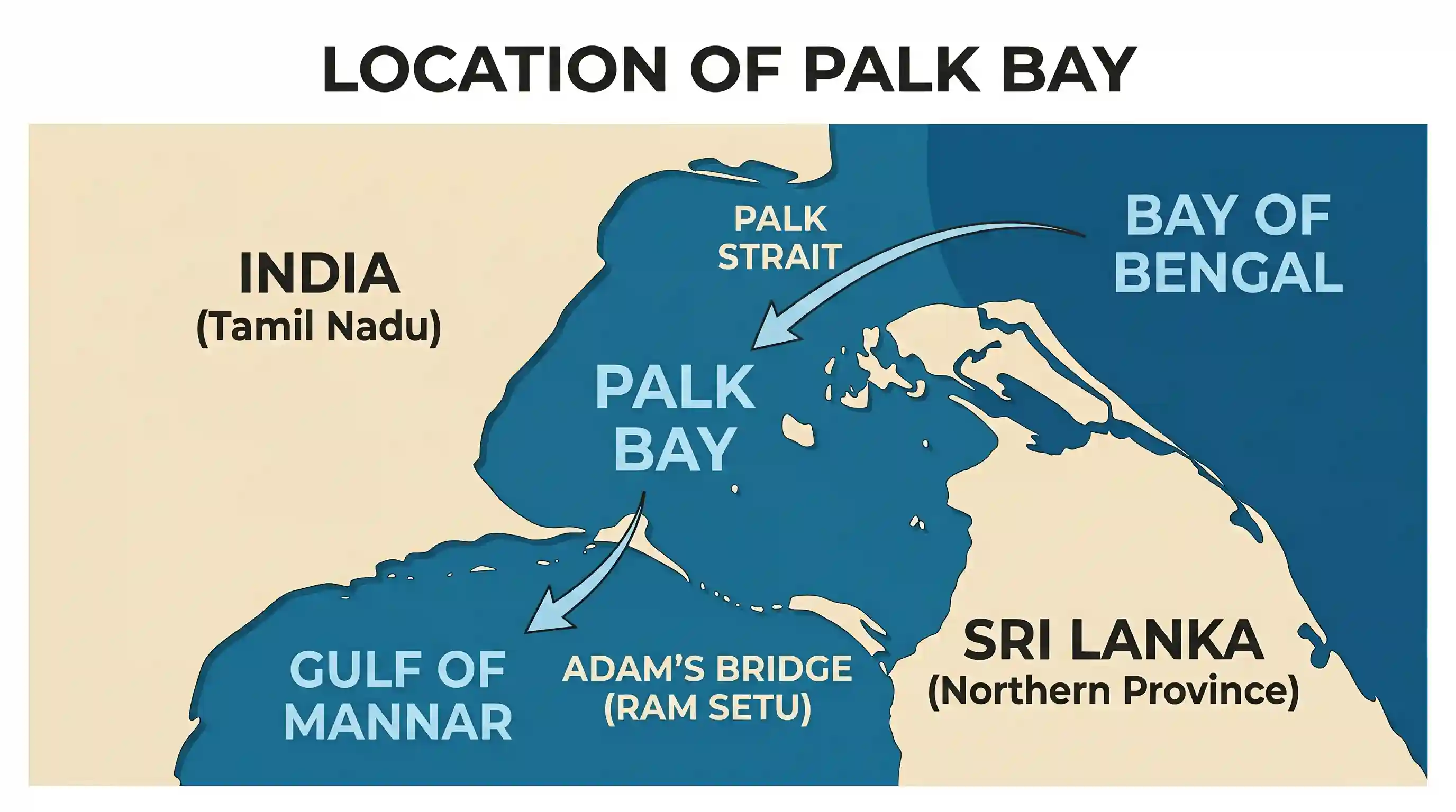
The Palk Bay is a semi enclosed body of water located between the southeast coast of India and the northern coast of Sri Lanka. It is bounded on the south by Adam s Bridge and the Gulf of Mannar and on the northeast by the Bay of Bengal. Geographically, the Palk Strait connects the Bay of Bengal in the northeast with the Palk Bay, which then leads into the Gulf of Mannar to the south. Therefore, the Palk Bay serves as a transition zone situated between the Gulf of Mannar and the Bay of Bengal.
Related questions
More UPSC Prelims practice from the same subject and topic.
- Prelims 1996GS1geography
Which of the following pairs of states and their important crops are correctly matched? I. Kerala: Tapioca II. Maharashtra: Cotton III. W. Bengal: Jute IV. Gujarat: Groundnut Select the correct answer…
- Prelims 1996GS1geography
Which one of the following rivers thrice forks into two streams and reunites a few miles farther on, thus forming the islands of Srirangappattanam, Sivasamudram and Srirangam?
- Prelims 1996GS1geography
As per the 1991 Census, which one of the following states has a lower population density than the other three?
- Prelims 1996GS1geography
‘Saddle Peak’, the highest peak of Andaman and Nicobar Islands, is located in
- Prelims 1996GS1geography
Match List I (Ores) with List II (States where they are mined) and select the correct answer by using the codes given below the lists: List I I. Manganese II. Nickel III. Lead zinc IV. Asbestos List I…
- Prelims 1996GS1geography
Which of the following pairs are correctly matched? I. Idukki ... Thermal power station II. Sabarigiri ... Hydro-electric project III. Ghatprabha ... Irrigation project IV. Ramganga ... Multipurpose p…