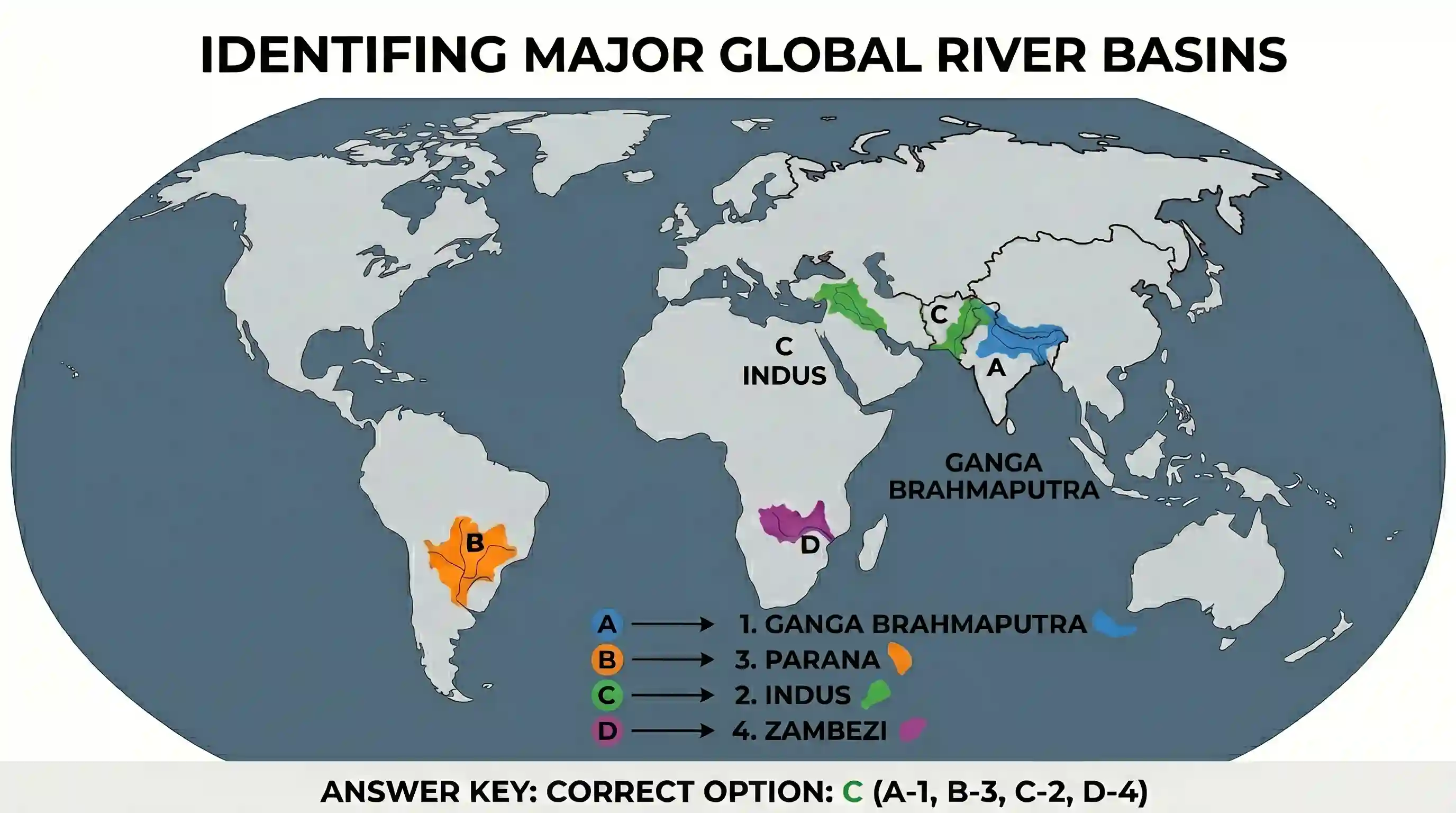
Match the drainage basins labelled as A, B, C and D with the names listed below and select the correct answer using the codes given below the names of the drainage basins. 1. Ganga Brahmaputra 2. Indus 3. Parana 4. Zambezi Codes:

- AA-3, B-1, C-2, D-4
- BA-1, B-3, C-4, D-2
- CA-1, B-3, C-2, D-4Correct
- DA-3, B-1, C-4, D-2
Explanation
The correct answer is C because it accurately identifies the geographic locations of the four major river basins based on global mapping.
Drainage basin A represents the Ganga Brahmaputra basin located in South Asia, primarily covering parts of India and Bangladesh.
Drainage basin B represents the Parana basin located in South America, flowing through Brazil, Paraguay, and Argentina.
Drainage basin C represents the Indus basin located in Southern Asia, primarily covering regions in Pakistan and Northern India.
Drainage basin D represents the Zambezi basin located in Southern Africa, which flows into the Indian Ocean.
Therefore, the matching sequence is A-1, B-3, C-2, and D-4.
Related questions
More UPSC Prelims practice from the same subject and topic.
- Prelims 2000GS1geography
Along which one of the following meridians did India experience the first light of the sunrise of the new millennium?
- Prelims 2000GS1geography
Which one of the following statements is not true?
- Prelims 2000GS1geography
The correct sequence in decreasing order of the four sugarcane producing States in India is
- Prelims 2000GS1geography
Consider the following statements: I. Maharashtra has the highest acreage under jawar in India. II. Gujarat is the largest producer of groundnut in India. III. Rajasthan has the largest area of cultiv…
- Prelims 2000GS1geography
Which one of the following ports of India handles the highest tonnage of import cargo?
- Prelims 2000GS1geography
Consider the following statements: I. Tides are of great help in navigation and fishing. II. High tide enables big ships to enter or leave the harbour safely. III. Tide prevents siltation in the harbo…