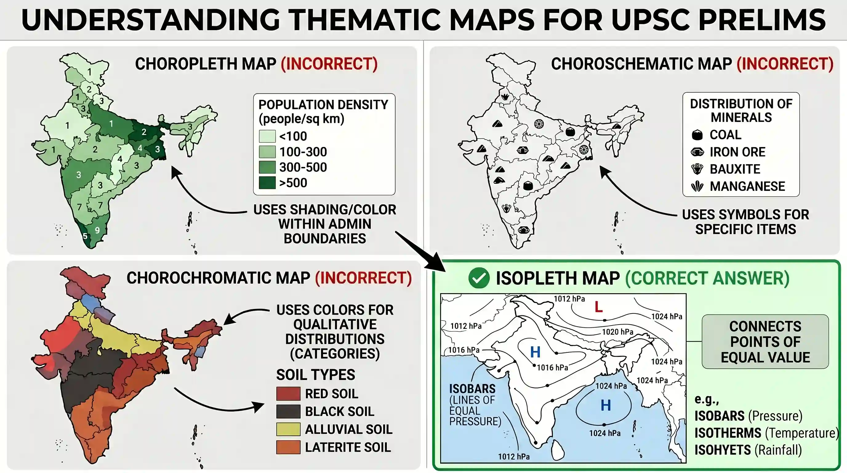
Daily weather map showing isobars is an example of
- AChoropleth map
- BIsopleth mapCorrect
- CChorochromatic map
- DChoroschematic map
Explanation
The correct answer is B because an isopleth map uses lines to connect points of equal value for a specific phenomenon. The prefix iso means equal. In a weather map, isobars are lines that connect locations with the same atmospheric pressure. Other common examples of isopleth maps include isotherms for temperature and isohyets for rainfall.
Option A is incorrect because choropleth maps use shading or coloring to represent data within predefined administrative boundaries like states or districts. Option C refers to maps using colors to show qualitative distributions like soil or vegetation types without using lines of equal value. Option D refers to maps using symbols to represent the distribution of specific items like minerals or industries.
Related questions
More UPSC Prelims practice from the same subject and topic.
- Prelims 1997GS1geography
Match List I with List II and select the correct answer by using the codes given below the lists: List I List II (Climatic Conditions) (Reasons) I. Chennai is warmer than Calcutta A) North-east Monsoo…
- Prelims 1997GS1geography
About 50% of the world population is concentrated between the latitudes of
- Prelims 1997GS1geography
Match List I with List II and select the correct answer using the codes given below the lists: List I List II I. Deccan Traps A) Late Cenozoic II. Western Ghats B) Pre-Cambrian III. Aravalli C) Cretac…
- Prelims 1997GS1geography
The January isotherm taken as a basis for dividing India into tropical and sub-tropical zones is
- Prelims 1997GS1geography
“……They are people of yellow complexion, oblique eyes, high cheek bones, sparse hair and medium height.” The reference here is to
- Prelims 1997GS1geography
What is the correct sequence of the descending order of the following States in respect of female literacy rates as per the 1991 Census? I. Mizoram II. Kerala III. Goa IV. Nagaland Choose the correct …