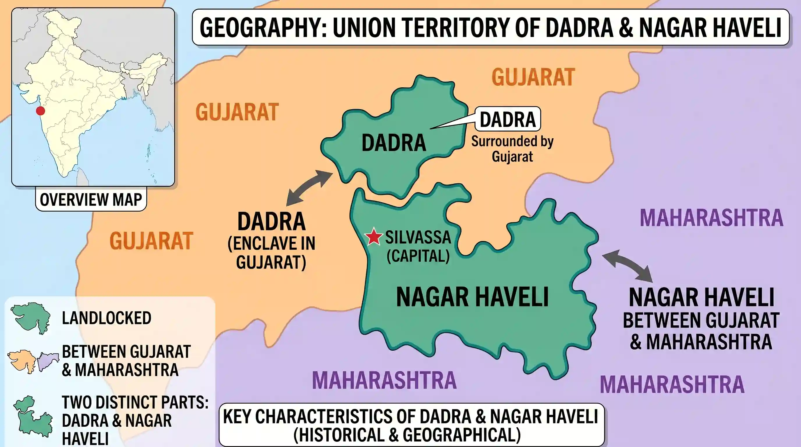
The above map is the Union Territory of
- AChandigarh
- BDaman and Diu
- CDadra and Nagar HaveliCorrect
- DPondicherry
Explanation
The correct answer is C because the map shows Dadra and Nagar Haveli, which is characterized by its unique landlocked shape situated between the states of Gujarat and Maharashtra. This Union Territory consists of two distinct geographical entities: Dadra, which is an enclave within Gujarat, and Nagar Haveli, which lies between Gujarat and Maharashtra. Its irregular borders and inland position distinguish it from the coastal structures of Daman, Diu, or Pondicherry, and the planned urban layout of Chandigarh. Note that while Dadra and Nagar Haveli has since been merged with Daman and Diu into a single administrative unit, historically and geographically, this specific map represents the Dadra and Nagar Haveli region.
Related questions
More UPSC Prelims practice from the same subject and topic.
- Prelims 2001GS1geography
In the above map, the black marks show the distribution of
- Prelims 2001GS1geography
Consider the decadal Census data given below: Decadal Population (in millions) Population 1961 10.7 1971 14.3 1981 16.2 1991 18.9 The above data refer to which one of the ‘Population by Religion’ Grou…
- Prelims 2001GS1geography
Identify the correct order of the processes of soil erosion from the following:
- Prelims 2001GS1geography
The temperature and rainfall of a meteorological station are given below: J F M A M J J A S O N D Temperature (°C) 9.4 10.6 11.7 12.2 13.3 13.9 13.9 14.4 15.6 15.0 13.3 10.6 Rainfall (cm) 12.2 9.1 7.9…
- Prelims 2001GS1geography
Match List I with List II and select the correct answer using the codes given below the Lists: List I (Local Wind) (Region) I. Fohn A) Argentina II. Samun B) Kurdistan III. Santa Ana C) California IV.…
- Prelims 2001GS1geography
The largest number of Buddhists is found in