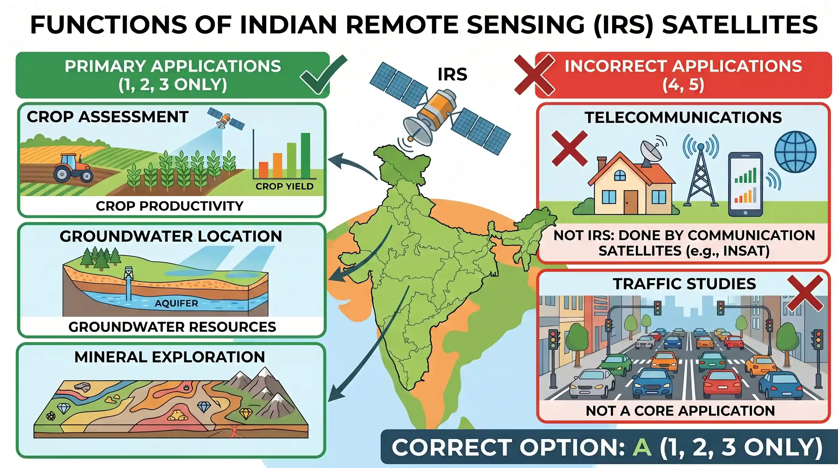
In which of the following activities are Indian Remote Sensing (IRS) satellites used? 1. Assessment of crop productivity 2. Locating groundwater resources 3. Mineral exploration 4. Telecommunications 5. Traffic studies Select the correct answer using the code given below.
- A1, 2 and 3 onlyCorrect
- B4 and 5 only
- C1 and 2 only
- D1, 2, 3, 4 and 5
Explanation
Indian Remote Sensing (IRS) satellites are primarily designed and used for Earth observation, resource management, and environmental monitoring. Their applications include:
- Assessment of crop productivity: Remote sensing data is extensively used in agriculture for crop mapping, yield estimation, monitoring crop health, and assessing drought conditions. This makes statement 1 correct.
- Locating groundwater resources: Satellite imagery helps in identifying geological structures, landforms, and vegetation patterns that indicate the presence of groundwater potential. This makes statement 2 correct.
- Mineral exploration: Remote sensing techniques assist in geological mapping, identifying mineral-rich areas, and structural features associated with mineral deposits. This makes statement 3 correct.
- Telecommunications: This is the primary function of communication satellites (like India's INSAT series), not remote sensing satellites. Remote sensing satellites capture data about the Earth's surface, they do not facilitate telephone, internet, or television communication directly. This makes statement 4 incorrect.
- Traffic studies: While high-resolution satellite imagery can potentially be used for urban planning and traffic monitoring, it's not a primary or core application commonly associated with the broader functions of IRS satellites compared to the first three. However, the most definitive incorrect option is telecommunications. Given the options, 1, 2, and 3 are the most direct and well-established applications. Thus, the correct combination is 1, 2, and 3 only.
Related questions
More UPSC Prelims practice from the same subject and topic.
- Prelims 2015GS1science-and-technology
The term 'Goldilocks Zone' is often seen in the news in the context of
- Prelims 2015GS1science-and-technology
Which of the following statements is/are correct regarding National Innovation Foundation-India (NIF)? 1. NIF is an autonomous body of the Department of Science and Technology under the Central Govern…
- Prelims 2015GS1science-and-technology
With reference to the use of nano-technology in health sector, which of the following statements is/are correct? 1. Targeted drug delivery is made possible by nanotechnology. 2. Nanotechnology can lar…
- Prelims 2015GS1science-and-technology
In the context of modern scientific research, consider the following statements about 'IceCube', a particle detector located at South Pole, which was recently in the news: 1. It is the world's largest…
- Prelims 2015GS1science-and-technology
With reference to 'Near Field Communication (NFC) Technology', which of the following statements is/are correct? 1. It is a contactless communication technology that uses electromagnetic radio fields.…
- Prelims 2015GS1science-and-technology
The Genetic Engineering Appraisal Committee is constituted under the