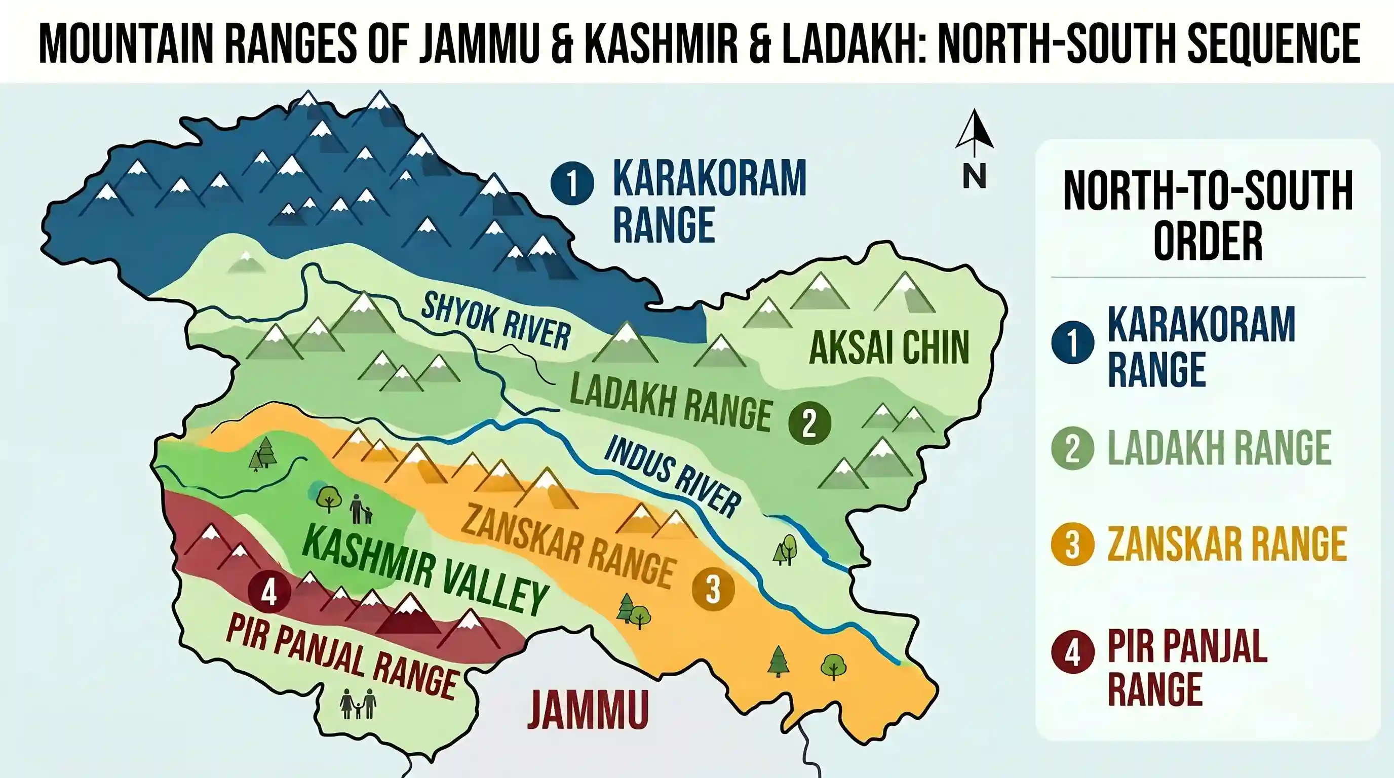
Examine the map of Jammu and Kashmir given below: The mountain ranges marked 1, 2, 3 and 4 are respectively
- ALadakh, Zanskar, Karakoram and Pir Panjal
- BKarakoram, Ladakh, Zanskar and Pir PanjalCorrect
- CKarakoram, Zanskar, Pir Panjal and Ladakh
- DLadakh, Pir Panjal, Karakoram and Zanskar
Explanation
The correct order of the mountain ranges from north to south in this region is Karakoram, Ladakh, Zanskar, and Pir Panjal.
The Karakoram Range is the northernmost range, forming India frontier with China and Pakistan. Moving south, the Ladakh Range lies between the Indus and Shyok rivers. Further south is the Zanskar Range, which separates the Indus Valley from the Kashmir Valley. Finally, the Pir Panjal Range is the southernmost range shown, located in the Lesser Himalayas.
Option B correctly matches this geographical sequence from top to bottom.
Related questions
More UPSC Prelims practice from the same subject and topic.
- Prelims 1995GS1geography
The Alpine vegetation in the western Himalayas is found only up to a height of 3000 metres, while in the eastern Himalayas it is found up to a height of 4000 metres, The reason for this variation in t…
- Prelims 1995GS1geography
Coffee cultivation in Sri Lanka was abandoned because of the disease
- Prelims 1995GS1geography
Which one of the following mountain ranges is spread over only one State in India?
- Prelims 1995GS1geography
Arakan Yoma is the extension of the Himalayas located in
- Prelims 1995GS1geography
The national highway from Delhi to Calcutta via Mathura and Varanasi is numbered
- Prelims 1995GS1geography
A meteor is