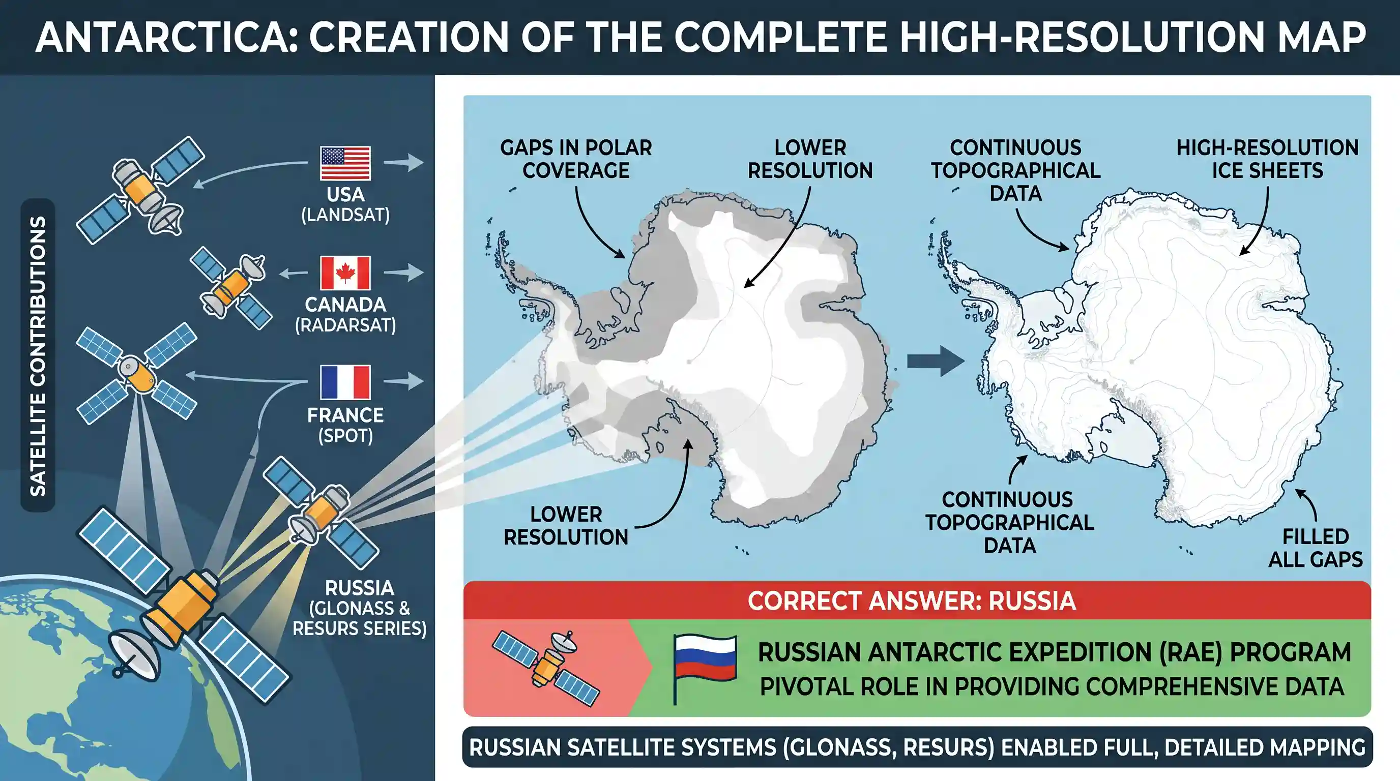
The satellites of which one of the following countries have helped in the preparation of a detailed and complete map of Antarctica?
- ACanada
- BFrance
- CRussiaCorrect
- DUSA
Explanation
The correct answer is C because Russia, through its RAE (Russian Antarctic Expedition) and the use of its satellite systems like GLONASS and the Resurs series, played a pivotal role in creating high resolution and comprehensive topographical maps of the Antarctic continent. While other nations have contributed to polar mapping, Russian satellite data was instrumental in filling significant gaps to produce a detailed and complete map of the entire region.
Related questions
More UPSC Prelims practice from the same subject and topic.
- Prelims 1998GS1geography
Olympics 2000 is to be held in
- Prelims 1998GS1geography
When there is noon at G. M.T. meridian people on another place of the Earth are taking their 6 o’clock morning tea. The longitude of the place is
- Prelims 1998GS1geography
Consider the following statements regarding asteroids: I. Asteroids are rocky debris of varying sizes orbiting the Sun. II. Most of the asteroids are small but some have diameter as large as 1000 km. …
- Prelims 1998GS1geography
Match List I with List II and select the correct answer by using the codes given below the lists: List I List II (Special Characteristic) (Name of Planet) I. Farthest planet from the sun A) Mercury II…
- Prelims 1998GS1geography
One Astronomical Unit is the average distance between
- Prelims 1998GS1geography
One local and another express train were proceeding in the same direction on parallel tracks at 29 km/hour and 65 km/hour respectively. The driver of the former noticed that it took exactly 16 seconds…